| Äußerer Bärenbartkogel | |
|---|---|
 | |
| Highest point | |
| Elevation | 3,473 m (11,394 ft) |
| Prominence | 167 m (548 ft) |
| Parent peak | Weißkugel |
| Coordinates | 46°47′51″N 10°41′56″E / 46.79750°N 10.69889°E |
| Geography | |
 Äußerer Bärenbartkogel | |
| Climbing | |
| First ascent | 1909 by Fridolin Hohenleitner and J. Plattner |
| Easiest route | East ridge |
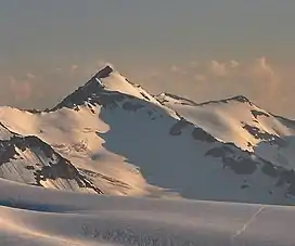
The Äußerer Bärenbartkogel (Italian: Cima Barba d'Orsa di Fuori) is a mountain in the Planeil group of the Ötztal Alps in South Tyrol, Italy.
References
- Walter Klier, Alpenvereinsführer Ötztaler Alpen, München 2006, ISBN 3-7633-1123-8
- Alpine Club Map 1:25.000, Sheet 30/2, Ötztaler Alpen, Weißkugel
- Tobacco-Verlag, Udine, Carta topografica 1:25.000, Sheet 043, Alta Val Venosta / Vinschgauer Oberland
This article is issued from Wikipedia. The text is licensed under Creative Commons - Attribution - Sharealike. Additional terms may apply for the media files.