Aizkraukle | |
|---|---|
Town | |
 | |
 Flag  Coat of arms | |
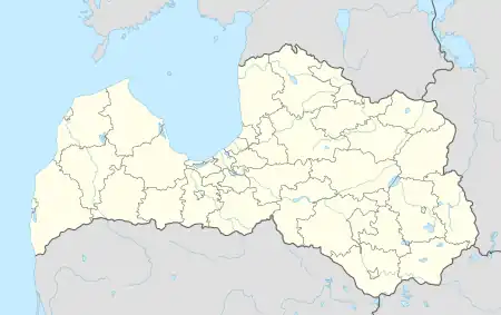 Aizkraukle Location in Latvia | |
| Coordinates: 56°36′15″N 25°15′14″E / 56.60417°N 25.25389°E | |
| Country | |
| Municipality | Aizkraukle Municipality |
| Town rights | 1967 |
| Area | |
| • Total | 12.93 km2 (4.99 sq mi) |
| • Land | 8.04 km2 (3.10 sq mi) |
| • Water | 4.89 km2 (1.89 sq mi) |
| Population (2023)[2] | |
| • Total | 6,947 |
| • Density | 540/km2 (1,400/sq mi) |
| Time zone | UTC+2 (EET) |
| • Summer (DST) | UTC+3 (EEST) |
| Postal code | LV-510(1-3) |
| Calling code | +371 651 |
| Website | www |
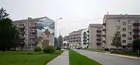
Aizkraukle (German: Ascheraden) is a town[3] in Vidzeme region in Latvia, the administrative centre of Aizkraukle Municipality on the right bank of the Daugava River. The population in 2020 was 7,018.[4]
History
In the second half of the 14th century Livonian Order built the Aizkraukle Castle, a few kilometres downstream from the ancient hillfort of Livs. The ruins of the castle still remain today. Before World War I, the settlement that stood near the site of modern-day Aizkraukle was known by its German name of Ascheraden.
The modern town was established in 1961 as a settlement to house the builders of the nearby hydroelectric power plant of Pļaviņas.[5] It was originally called Stučka[6] (or "Стучка", Stuchka[7] and "имени Петра Стучки", imeni Petra Stuchki[5] in Russian), for Pēteris Stučka, a Latvian communist.[5] Town status was granted to it in 1967,[5][6] which is also when it became the administrative center of Stučkas District. In 1990, it was renamed Aizkraukle, after the nearest railway station.[5] The name literally means beyond the Kraukle River.[5]
Economy
General industries in the area include power generation, woodworking, printing, and agriculture.
In 2004 Aizkraukle was awarded "The tidiest town in Latvia 2004" in its size group.
.jpg.webp) Aizkraukle Saint Thérèse of the Child Jesus Roman Catholic Church
Aizkraukle Saint Thérèse of the Child Jesus Roman Catholic Church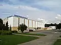 Soviet-era supermarket
See also
Citations and references
- ↑ "Reģionu, novadu, pilsētu un pagastu kopējā un sauszemes platība gada sākumā". Central Statistical Bureau of Latvia. Retrieved 18 January 2023.
- ↑ "Iedzīvotāju skaits pēc tautības reģionos, pilsētās, novados, pagastos, apkaimēs un blīvi apdzīvotās teritorijās gada sākumā (pēc administratīvi teritoriālās reformas 2021. gadā) 2021 - 2022". Central Statistical Bureau of Latvia. Retrieved 2 October 2023.
- ↑ "Administratīvo teritoriju un apdzīvoto vietu likums". Archived from the original on 2020-08-18.
- ↑ "ISG020. Population number and its change by statistical region, city, town, 21 development centres and county". Central Statistical Bureau of Latvia. 2020-01-01. Retrieved 2021-02-12.
- 1 2 3 4 5 6 Pospelov, p. 24
- 1 2 Latvijas PSR Administratīvi Teritoriālais Iedalījums, p. 47
- ↑ Latvijas PSR Administratīvi Teritoriālais Iedalījums, p. 118
Cited sources
- Е. М. Поспелов (Ye. M. Pospelov). "Имена городов: вчера и сегодня (1917–1992). Топонимический словарь." City Names: Yesterday and Today (1917–1992). Toponymic Dictionary." Москва, "Русские словари", 1993.
- Latvijas PSR Augstakās Padomes Prezidija Padomju Darba Jautājumu Daļa. Latvijas PSR Administratīvi Teritoriālais Iedalījums. 1978. gads. Izdevnieciba "Liesma", Riga 1978.