Jørstadmoen | |
|---|---|
Village | |
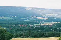 View of the village | |
 Jørstadmoen Location of the village  Jørstadmoen Jørstadmoen (Norway) | |
| Coordinates: 61°08′44″N 10°23′04″E / 61.14558°N 10.38458°E | |
| Country | Norway |
| Region | Eastern Norway |
| County | Innlandet |
| District | Gudbrandsdalen |
| Municipality | Lillehammer Municipality |
| Area | |
| • Total | 0.8 km2 (0.3 sq mi) |
| Elevation | 138 m (453 ft) |
| Population (2021)[1] | |
| • Total | 661 |
| • Density | 825/km2 (2,140/sq mi) |
| Time zone | UTC+01:00 (CET) |
| • Summer (DST) | UTC+02:00 (CEST) |
| Post Code | 2625 Fåberg |
Jørstadmoen is a village in Lillehammer Municipality in Innlandet county, Norway. The village is located along the river Gudbrandsdalslågen, about 4 kilometres (2.5 mi) to the northwest of the town of Lillehammer.
The 0.8-square-kilometre (200-acre) village has a population (2021) of 661 and a population density of 825 inhabitants per square kilometre (2,140/sq mi).[1]
The village is the site of the Jørstadmoen leir, a military base that is the main base for the Norwegian Cyber Defence Force as well as the Cyber Engineer Academy. The village also has a school, grocery store, and sports facilities.[3]
References
- 1 2 3 Statistisk sentralbyrå (1 January 2021). "Urban settlements. Population and area, by municipality".
- ↑ "Jorstadmoen, Lillehammer". yr.no. Retrieved 4 July 2022.
- ↑ Thorsnæs, Geir, ed. (30 May 2022). "Jørstadmoen". Store norske leksikon (in Norwegian). Kunnskapsforlaget. Retrieved 4 July 2022.
This article is issued from Wikipedia. The text is licensed under Creative Commons - Attribution - Sharealike. Additional terms may apply for the media files.