Kungsleden
Kungsleden ("King of Trails") is a 430-km-long walk in northern Sweden, from Abisko to Hemavan, through part of Sápmi, the region inhabited by the Sámi people. The trail passes through the Laponia national parks, the largest wilderness area of Europe.
At Sälka, the trail passes Kebnekaise, the highest mountain in Sweden.
Stages
| Stage | Distance (km) | Stage Goal | Notes |
|---|---|---|---|
| 🌍 Abisko | Trailhead, restaurant, bath, sauna, grocery store | ||
| 1 | 15 | 🌍 STF Abiskojaure Fjällstuga | Kitchen, large store, bath |
| 2 | 19 | 🌍 STF Alesjaure Fjällstuga | Kitchen, large store, sauna, bath |
| 3 | 13 | 🌍 STF Tjäktja Fjällstuga | Kitchen |
| 4 | 12 | 🌍 STF Sälka Fjällstuga | Kitchen, large store, sauna |
| 5 | 12 | 🌍 STF Singi Fjällstuga | Kitchen |
| 6 | 13 | 🌍 STF Kaitumjaure Fjällstuga | Kitchen, small store |
| 7 | 9 | 🌍 STF Teusajaure Fjällstuga | Sauna, boat 150 kr (2024, member), small store |
| 8 | - | 🌍 STF Saltoluokta Fjällstation | Restaurant, sauna, Wi-Fi, boat 2 km 175 kr (2024, member), resupply point |
| 9 | 20 | 🌍 STF Sitojaure Fjällstuga | Kitchen |
| 10 | 9 | 🌍 STF Aktse Fjällstuga | Kitchen, large store, boat 300 kr (2024) |
| 11 | 20 | 🌍 STF Pårte Fjällstuga | Kitchen, bath |
| 12 | 17 | 🌍 Kvikkjokk | Restaurant, small store, sauna, Wi-Fi, bus, bath, Boat 150 kr (2011), resupply point |
| 13 | 12 | 🌍 Tsielekjåkkstugan | |
| 14 | 20 | 🌍 Piteälven | |
| 15 | 17 | 🌍 Gásakláhko | |
| 16 | 13 | 🌍 Vuonatjviken | Small store, boat 300 kr (2011) |
| 17 | 18 | 🌍 Jäkkvik | Kitchen, sauna, bus, grocery store, resupply point |
| 18 | 21 | 🌍 Adolfsström | Café, small store, sauna |
| 19 | 23 | 🌍 Sjnulttjie Rest Cabin | |
| 20 | 46 | 🌍 Ammarnäs | Kitchen, restaurant, sauna, bath, Wi-Fi, bus, grocery store, resupply point |
| 21 | 8 | 🌍 STF Aigert Fjällstuga | Kitchen, small store, sauna, bath |
| 22 | 20 | 🌍 STF Serve Fjällstuga | Kitchen |
| 23 | 14 | 🌍 STF Tärnasjö Fjällstuga | Kitchen, large store, sauna, bath |
| 24 | 14 | 🌍 STF Syter Fjällstuga | Kitchen, small store, bath |
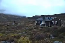
| 25 | 12 | 🌍 STF Viterskalet Fjällstuga | Kitchen, small store |
| 26 | 11 | 🌍 Hemavan | Trailhead, restaurant, sauna, bath, grocery store |
Prepare
The Kungsleden's beauty is matched only by the ferocity of its mosquitoes, especially during the summer months. Be prepared for swarms, particularly near water and in the evenings. To avoid becoming a walking buffet, pack strong insect repellent. We highly recommend 40% DEET spray for reliable, long-lasting protection. Repellent devices are also a great option. Consider a mosquito head net for extra comfort during peak biting hours, and wear light-colored, long-sleeved clothing when possible.
Kungsleden's weather is highly changeable. Be prepared for rapid shifts from hot sunshine (potentially 30°C) to thunderstorms. The weather closer to Abisko can drop to around freezing in late July. Pack clothing suitable for both extremes and choose campsites carefully, considering potential storm hazards.
Walk
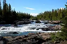
Abisko - Abiskojaure (15 km)
The trail begins with a series of wooden boards displaying the major peaks and points of interest along Kungsleden. It then passes beneath the train tracks before continuing through a mix of hiking and quad trails. Camping is allowed outside of Abisko National Park, and there is a campsite right on the edge of the park, in the forest.
Abiskojaure - Alesjaure (19 km)
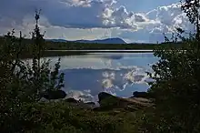
A boat option to Alesjaure is available for 240 kr (2011). The area also features several meditation spots along the Dag Hammarskjöldsleden trail. Alesjaure is a beautiful glacier lake, the STF cabin here has a store, and a lot of camping spots right over the bridge.
Alesjaure - Tjäktja (13 km)
From here, the trail gradually leads up to Tjäktja, with plenty of camping opportunities along the way, and quite flat terrain.
Tjäktja - Sälka (12 km)

The Tjäktja hut is situated just off the trail to the right, accessible by a short detour. Immediately after the hut, Kungsleden reaches its highest point, Tjäktjapasset, at 1150 meters. There is an emergency cabin available here as well. From Abisko to Sälka the trail coincides with Nordkalottleden, which then turns to the Norvegian Narvik fells and ends in Kvikkjokk farther on Kungsleden.
Sälka - Singi (13 km)
Sälka is located close to the Sälka peak, which has a glacier you should be able to spot from a distance. The stretch from Sälka to Singi is relatively straightforward, and entirely above the tree-line.
Singi - Kaitumjaure (9 km)
After Singi, the path follows a river through the Ladtjovagge valley. Kaitumjaure is located in a small forest, which offers some shelter from the wind.
Teusajaure - Vakkotavare (14 km)
After Teusajaure, you’ll take a short boat ride across the lake. Keep in mind that while the boat operates twice daily, there is only one bus per day, so it’s essential to catch the morning boat. If you’re coming from the south, the boat will arrive in about 15 minutes. To signal the ferry, hoist the flag. Note that service may be canceled due to weather conditions. Both card and cash payments are accepted. While rowboats are available, they are not recommended for this stretch.
On the other side, you’ll begin a steady ascent above the tree line, crossing a tundra plain before descending alongside a waterfall, eventually reaching 🌍 STF Vakkotavare Fjällstuga. From there, you will be able to take a bus for 47 km, costing 55 kr (2011). The stop is Kebnats, and Saltoluokta is just a boat ride away. Visitors to Saltoluokta can enjoy various amenities, including kayak rentals, saunas, and a restaurant offering a unique dining experience.
Saltoluokta - Sitojaure (20 km)
The trail gently ascends, leading to a vast mountain plateau. Just before reaching Sitojaure, it descends once more.
Sitojaure - Aktse (9 km)
Near Aktse lies Skierffe (1200 m), a popular cliff with a view of Rapadalen. Most hikers camp above the treeline, where the trail branches off toward Skierffe. From there, the round-trip hike takes approximately eight hours.
Aktse - Pårte (20 km)
A boat travels between Aktse and the continuation of Kungsleden. A boat travels between Aktse and the continuation of Kungsleden. The crossing from the south side to Aktse takes about 15 minutes. Southbound travelers should inform the hut warden in advance, while those heading north must hoist a flag at least half an hour before the departure time to request a ride. Cash may be required for payment, and if there is high demand, the first boat of the morning may depart as early as 8:30 AM. Contact Anne-Sophie at ☏ +46706735513.
Pårte - Kvikkjokk (17 km)
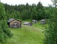
At Kvikkjokk, there is a large mountain station with a small store and a restaurant. Lodgings here include showers and a washing machine. The mountain station is beautiful, and contains a special area also known as the "Myggveranda" or "Mosquito porch". This veranda provides a stunning view of the nearby rapids along the Gamájåhkå. The mountain station has dormitories as well as rooms available. Rosbacken is a great place to camp in Kvikkjokk.
Kvikkjokk - Tsielekjåkkstugan (12 km)
A boat tour runs between Kvikkjokk and a small emergency cabin across the lake, with ferry departures twice daily—once in the morning and once in the afternoon. Call Helena Adolfsson ☏ +46738006232 for booking information. If arriving from the south, expect a 30-minute wait for the ferry. The emergency cabin contains a basic phone, but keep in mind that it is neither airtight nor well-sealed. Located in a swamp, the cabin is prone to heavy mosquito activity in the summer, and they will find their way inside.
The climb upwards from the lakeside is steep, and can be slippery on descent. Tsielekjåhkåstugan is an emergency cabin, what lies ahead is the longest stretch of trail without cabins.
Tsielekjåkkstugan - Piteälven (20 km)
This section features some of the most rugged terrain on Kungsleden, offering a stunning view of the Goabddabákte mountain, which the trail passes right by. The trail crosses the Piteälven River, and some sections may be flooded during high water levels. On the opposite side of the river, near the lake, you’ll find campsites and a small fireplace.
Piteälven - Gásakláhko (17 km)
Here the trail passes by a small torvkåta (turf hut) stranded in the middle of a rock field.
Gásakláhko - Vuonatjviken (13 km)
On this stage the polar circle is passed, there is a small wooden sign indicating the location of the polar circle. At Vuonatjviken, there is a small store that belongs to the family who owns the village.
Vuonatjviken - Jäkkvik (18 km)
A boat will transport you across Lake Riebnes from Vuonatjviken. If you’re coming from the south, be aware that there is limited cell reception between Jäkkvik and Vuonatjviken, and the boat will not pick you up unless you’ve made a reservation in advance. Call Jan Johansson ☏ +46730358673 or Eva Johansson ☏ +46706968045. It takes around 30 minutes for the boat to cross the lake. After this boat ride, expect a long ascent and descent, followed by a rowing section. There are three boats in this area. If the side you're on has only one boat available, you’ll need to row across three times: first to reach the other side, then back while dragging another boat, and again to ensure one boat remains available at all times. In Jäkkvik, you can camp near Kyrkans Fjällgård, where lodging is also available, along with a kitchen. The town has an ICA Supermarket, offering dried food and mosquito repellent.
Jäkkvik - Adolfström (21 km)
Shortly after Jäkkvik, there is a small hut with a fireplace. Most of the trail passes through a dense forest, with a large amount of rocks and boulders. Adolfström has an amazing café with a small store: Adolfströms Handelsbod
There is a large camping available, as well as cottages which can be rented, see Campsite Adofström, Adolfströms camping. A farm near Adolfström Hyttruin also offers camping spots. A small lake can be found here as well.
Adolfström - Raststuga Sjnulttjie (23 km)
You can also take a boat directly to Bäverholmen, though it is not an official part of Kungsleden. Bäverholmen has a restaurant open from 12:00 to 18:00. After crossing a bridge, you reach 🌍 Bárasjuhka, which features an emergency cabin and a small campsite. The coming two sections go through a large swamp. In the middle of the swamp, there is a short detour to a cabin called Sjnulttjie. This cabin is unfortunately not airtight. Plenty of mosquitos can and will enter this cabin if you have to sleep here. It's recommended to hike until you get out of the swampy area, and onto higher ground, rather than stop at the cabin.
Raststuga Sjnulttjie - Ammarnäs (46 km)
On the way to Ammarnäs you will walk by 🌍 Rävfallsstugan. To stay here, one has to reserve and pick up a key in advance, which costs 150 kr (2019). The key has to be returned by mail to Ammarnäs Livs when coming from the southern direction. The cabin also has a sauna, for which you have to chop wood yourself.
Ammarnäs has a grocery store called Ammarnäs Livs. At the bus stop in Ammarnäs there is a free toilet and at the lawn behind the bus stop it is possible to camp for free. Guidecentrum close to the bus, Ammarnäs Wärdshus and Ammarnäsgården for eating. Ammarnäsgården also hosts Naturum, with tourist information and nature guides. Fjällvilt sells local reindeer and game products.
Ammarnäs - Aigertstugan (8 km)
You can bypass the Aigert stretch by taking a boat taxi across Tjulträsk with Thorbjörn from Ammarnäs Båt-Taxi. Reach him at ☏ +46706820971. He also provides a taxi service between Ammarnäs and the lakeshore, which is about an 8 km trip. Please note that only cash payments are accepted. After the boat ride, it’s a short 15-20 minute walk inland to Servestugan.
Otherwise, you leave Ammarnäs over a gravel road, hiking up past waterfalls until you reach Aigertstugan. Don't forget to look back on the way up, the views are fantastic.
Aigertstugan - Servestugan (20 km)
While Servestugan doesn’t have a sauna, there’s a lovely platform by the stream for washing up. If you prefer camping instead of staying in the cabin on the Aigert stretch, the best spot is at Vuomatjåhkka, a narrow valley to the west of the shelter. The rest of the stretch is either too exposed, rocky, or lacks nearby water. For a more picturesque camping spot, you can continue a little further west along the path and camp in the stream delta near Servestugan.
Servestugan - Tärnasjöstugan (14 km)
This area is low-lying and surrounded by lakes, which have a large amount of mosquitos during the summer. It’s best to camp higher up, above the treeline, to avoid the insects. However, there are still excellent camping options near the lakes if you prefer staying closer to the water.
Tärnasjöstugan - Syterstugan (14 km)
The boat service over Tärnasjö has been discontinued since 2017. Syterstugan accepts card payments. There are good tenting spots near the cabins. The eastern trail to Sytertoppen is accessible from this location.
Syterstugan - Viterskalsstugan (12 km)
There are excellent tenting spots throughout Syterskalet, particularly near its junction with Viterskalet. A newly constructed bridge at the western entrance of Syterskalet provides easier access to Sytertoppen from the west.
Viterskalsstugan - Hemavan (11 km)
The gondola, completed in 2019 after the old lift closed, offers transportation into the valley for those who prefer not to walk down. A single journey costs 125 kr for adults (2019) and operates from 10:00 to 17:00 during the summer. Several restaurants are open at different times throughout the year. The bar at Hemavan Vandrarhem stocks craft beer, and Hemavans Wärdshus is open from 18:00 to 21:00 on weekdays and 18:00 to 22:00 on weekends.
Get in
It is most common to start in Abisko (Abisko Turiststation). It is possible to reach Abisko with the night train from Stockholm. With aeroplane it is possible to reach Kiruna from Stockholm and continue with train or bus to Abisko.
Hemavan has an airport with connection to Stockholm. Reaching Stockholm with bus and train is also possible. Lapplandspilen was a direct coach route between Hemavan and Stockholm, that is discontinued.
For those not going to hike all the trail, there are bus connections to Vakkotavare (the bus to Ritsem), Saltoluokta (boat from Kebnats, which has bus from Gällivare via Porjus), Kvikkjokk, Jäkkvik and Ammarnäs. Nikkaluokta, near Kebnekaise, is also a popular starting point although not on Kungsleden by itself; the trail reaches Kungsleden by Singi (the next cabin after Sälka if coming from Abisko).
Helicopters are common in the Kungsleden area, some days it is possible to see more helicopters than people. Two operators are:
Maps
There are free digital maps available. Download them, as you will not have fast data (or even any mobile phone coverage) available at all places. And do not drop the device, have it drenched in rain or a river, have it stop working because of moisture, or have the batteries go flat. A paper map is recommended.
Sleep
Lodging
Price for a night in a hut is 420 kr for members, and 520 kr for non-members (2024). Children aged 6-15 years pay 210 kr for members and 260 kr for non-members (2024). Children under 6 years stay for free. Shared rooms, outhouse, and cooking facilities are available. Guests are required to bring their own linen or sleeping bag. Household duties (such as firewood chopping and carrying water) are shared by the guests.
The cabins are closed during the off-season, but at least one emergency room and an emergency phone remain accessible.
Camping
It is possible to stay by the cottages with a tent if one wishes to use the facilities. The price is 200 kr for members and 300 kr for non-members (2024). Children aged 6-15 years pay 140 kr for members and 240 kr for non-members (2024). Day visits are free for children, 40 kr for members, and 80 kr for non-members (2024).
Backcountry
Allemansrätten allows you to legally camp in most places for free, except within 100 m of a house. At this trail the main exception is in certain protected areas, such as the Abisko national park. It is also inadvisable to stay close to main reindeer pastures if herds are nearby, since this disturbs a vital economic activity in the area.
Eat
Food is available for purchase at many cottages along the trail and at some Sámi camps. While the selection may be limited, carrying your own food is not essential. However, be mindful of longer stretches without supplies, particularly between Jäkkvik and Kvikkjokk. Foraging for berries and mushrooms is allowed in most areas, following the usual precautions.
Some of the larger mountain huts will hold resupply boxes for hikers. This includes Kvikkjokk Fjällstation and Saltoluokta Fjällstation. The only way to ship packages to these stations is through Bussgods. Sending packages to Ammarnäs and Jäkkvik is largely unnecessary, since they both have grocery stores. The selection of dried food may be limited. If you have specific dietary requirements, or otherwise need to send resupply boxes, these two towns are also good options.
Fishing
Fishing by the trail is mostly allowed, but requires paying a fee to get a permit.
Drink
Plenty of water is available along the trail in most areas. Higher plateaus can be devoid of good sources especially in dry years, so it is worth checking with locals if conditions are drier than normal. It is fine to drink as long as the water is either moving (streams should be at least half a meter in width, as a rule of thumb), or large/deep enough to not get stagnant. Special care should be taken in lemming years, since dead carcasses may contaminate the water.
Books
- Berggren, Annika, Vandringsturer på Kungsleden: Abisko - Kvikkjokk, Vildmarksbiblioteket, Växjö, 2008.
- Berggren, Annika, Vandringsturer på Kungsleden: Kvikkjokk - Hemavan, Vildmarksbiblioteket, Växjö, 2009.
- Feldt, Kjell-Olof. Vår bästa tid är i fjällen. Stockholm: Norstedt, 1993.
- Grundsten, Claes. Kungsleden The Royal Trail Through Arctic Sweden. Herefordshire: Carreg Ltd, 2009.
- Grundsten, Claes. Abisko, Kebnekaise: [leder, utflyktsmål, bestigningar, stugor]. Stockholm: Norstedt, 2010.
- Hennemann, Michael. Schweden: Kungsleden. Welver: Stein, 2011.
- Karlsson, Bo. Sareks fyra årstider. Stockholm: Norstedt, 1982.
- Magnusson, Lars, Vandra i Sverige: en vägvisare till sevärdheterna längs Sveriges vandringsleder, Prisma i samarbete med Svenska turistföreningen, Stockholm, 2002.
- Neregård, Fredrik, Fjällvandra längs Kungsleden: Abisko - Kebnekaise, Calazo Förlag, 2011.
Go next
- Padjelantaleden — another trail through part of Laponia
- Södra Kungsleden — southward from Hemavan, in Dalarna, Härjedalen and Jämtland
- Lapplandsleden — southward from Hemavan, to Borgafjäll in Dorotea at the southern border of Swedish Lappland.
- Nordkalottleden — from Abisko to the north for some 380 km more of trekking, to Kautokeino in Norwegian Finnmark – or to the south-west from Sälka or west from Kvikkjokk, to Sulitjelma, likewise in Norway.