| Dyke | |
|---|---|
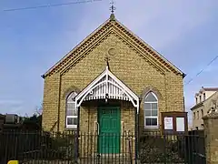 Baptist Chapel, Dyke | |
 Dyke Location within Lincolnshire | |
| OS grid reference | TF105225 |
| • London | 85 mi (137 km) S |
| Civil parish | |
| District | |
| Shire county | |
| Region | |
| Country | England |
| Sovereign state | United Kingdom |
| Post town | BOURNE |
| Postcode district | PE10 |
| Dialling code | 01778 |
| Police | Lincolnshire |
| Fire | Lincolnshire |
| Ambulance | East Midlands |
| UK Parliament | |
Dyke is a village in the South Kesteven district of Lincolnshire, England. It is situated less than 1 mile (1.6 km) east from the A15 road, and approximately 1 mile north-east from Bourne. Dyke is within Bourne civil parish.
The name Dyke arises from its lying on Car Dyke, a once much larger Roman ditch, which runs along the western edge of The Fens. The section of Car Dyke between Dyke and Bourne is a scheduled ancient monument.[1]
For population statistics Dyke, Twenty, South Fen, and Spalding road outside Bourne are taken together; Dyke is the largest of these settlements. The 2001 census recorded a population of 1,598,[2] falling to 1,541 at the 2011 census.[3]
Dyke and Dyke Fen fall within the drainage area of the Black Sluice Internal Drainage Board.[4]
A new fountain was built on the green in the centre of the village to mark the millennium.
Dyke's public house is The Wishing Well Inn.
References
- ↑ Historic England. "Listed portion of Car Dyke (1034975)". Research records (formerly PastScape). Retrieved 18 August 2009.
- ↑ "Office for National Statistics web site, 2001 census".
- ↑ "Area population 2011".
- ↑ "Black Sluice IDB".
External links
 Media related to Dyke, Lincolnshire at Wikimedia Commons
- "Dyke", homepages.which.net. Retrieved 22 July 2011