Harlan Township | |
|---|---|
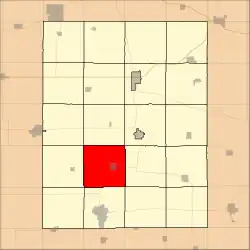 Location in Fayette County | |
| Coordinates: 42°46′51″N 91°54′45″W / 42.78083°N 91.91250°W | |
| Country | |
| State | |
| County | Fayette |
| Area | |
| • Total | 36.79 sq mi (95.28 km2) |
| • Land | 36.76 sq mi (95.22 km2) |
| • Water | 0.03 sq mi (0.07 km2) 0.07% |
| Elevation | 1,145 ft (349 m) |
| Population (2010) | |
| • Total | 871 |
| • Density | 24/sq mi (9.1/km2) |
| Time zone | UTC-6 (CST) |
| • Summer (DST) | UTC-5 (CDT) |
| ZIP codes | 50655, 50662, 50681, 52142, 52164 |
| GNIS feature ID | 0468005 |
Harlan Township is one of twenty townships in Fayette County, Iowa. As of the 2010 census, its population was 871.[1]
Geography
According to the United States Census Bureau, Harlan Township covers an area of 36.79 square miles (95.28 square kilometers); of this, 36.76 square miles (95.22 square kilometers, 99.94 percent) is land and 0.03 square miles (0.07 square kilometers, 0.07 percent) is water.
Cities, towns, villages
Adjacent townships
- Center Township (north)
- Westfield Township (northeast)
- Smithfield Township (east)
- Scott Township (southeast)
- Jefferson Township (south)
- Oran Township (southwest)
- Fremont Township (west)
- Banks Township (northwest)
Cemeteries
The township contains these two cemeteries: Hope and Long Grove.
Major highways
Landmarks
- City Park
- Twin Bridges County Park (east quarter)
School districts
- West Central Community School District
Political districts
- Iowa's 1st congressional district
- State House District 18
- State Senate District 9
References
External links
Municipalities and communities of Fayette County, Iowa, United States | ||
|---|---|---|
| Cities | Map of Iowa highlighting Fayette County | |
| Townships | ||
| Unincorporated communities | ||
| Footnotes | ‡This populated place also has portions in an adjacent county or counties | |
This article is issued from Wikipedia. The text is licensed under Creative Commons - Attribution - Sharealike. Additional terms may apply for the media files.