Horní Lhota | |
|---|---|
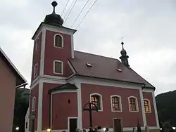 Church of Saint Denis of Paris | |
 Flag  Coat of arms | |
 Horní Lhota Location in the Czech Republic | |
| Coordinates: 49°9′16″N 17°48′16″E / 49.15444°N 17.80444°E | |
| Country | |
| Region | Zlín |
| District | Zlín |
| First mentioned | 1420 |
| Area | |
| • Total | 12.65 km2 (4.88 sq mi) |
| Elevation | 340 m (1,120 ft) |
| Population (2023-01-01)[1] | |
| • Total | 601 |
| • Density | 48/km2 (120/sq mi) |
| Time zone | UTC+1 (CET) |
| • Summer (DST) | UTC+2 (CEST) |
| Postal code | 763 23 |
| Website | www |
Horní Lhota is a municipality and village in Zlín District in the Zlín Region of the Czech Republic. It has about 600 inhabitants.
Horní Lhota lies approximately 14 kilometres (9 mi) south-east of Zlín and 265 km (165 mi) south-east of Prague.
References
Wikimedia Commons has media related to Horní Lhota (Zlín District).
This article is issued from Wikipedia. The text is licensed under Creative Commons - Attribution - Sharealike. Additional terms may apply for the media files.