Independencia Department | |
|---|---|
.png.webp) Location of Independencia Department within La Rioja Province | |
 Independencia Department Location of Independencia Department in Argentina | |
| Coordinates: 31°S 69°W / 31°S 69°W | |
| Country | |
| Province | La Rioja Province |
| Area | |
| • Total | 7,120 km2 (2,750 sq mi) |
| Population (2001) | |
| • Total | 2,405 |
| • Density | 0.34/km2 (0.87/sq mi) |
| [1] | |
| Demonym | Independense |
| Time zone | UTC-3 (ART) |
| Area code | 03732 |
Independencia is a department of La Rioja Province (Argentina).[2][3]
History
The department was created by Law 108 of 28 September 1864. This law also established Patquía as the head town.
Independencia
Geography
The department has 7,120 km² and borders to the north with the departments of Capital, Chilecito and Coronel Felipe Varela, to the east with the department of Angel Vicente Peñaloza, to the west with the province of San Juan and to the south with the department of Facundo Quiroga.
Gallery
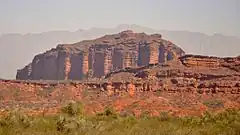
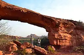 View of Los Colorados Provincial Reserve
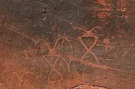 Rock paintings in Los Colorados
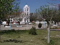 View to the Church of the town of Patquía
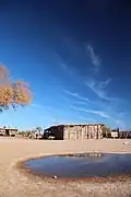 View of a home in the town of Patquía
 Panoramic view of Los Colorados Provincial Reserve
References
- ↑ 2001 census [INDEC]
- ↑ "Argentina: Administrative Division". citypopulation.
- ↑ CENTRO LATINOAMERICANO Y CARIBEÑO DE DEMOGRAFÍA (CELADE). World Bank. 1970.
This article is issued from Wikipedia. The text is licensed under Creative Commons - Attribution - Sharealike. Additional terms may apply for the media files.