| Kaukonahua River Kaukonahua Stream | |
|---|---|
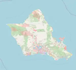 Location of mouth  Kaukonahua River (Hawaii) | |
| Location | |
| Country | United States |
| State | Hawaii |
| Region | Oahu |
| Physical characteristics | |
| Source | |
| • location | Oahu, Hawaii |
| • coordinates | 21°29′49″N 158°02′56″W / 21.4970382°N 158.0488229°W |
| Mouth | |
• location | Kaiʻaka Bay, Pacific Ocean |
• coordinates | 21°34′47″N 158°7′10″W / 21.57972°N 158.11944°W |
• elevation | Sea level |
| Length | ~ 53 km (33 mi) |
The Kaukonahua Stream[1] or Kaukonahua River is a 9.9-mile-long (15.9 km)[2] river on the island of Oʻahu which is one of the Hawaiian Islands. Including its longer South Fork, the stream's total length is 28.0 miles (45.1 km).[2] It flows down in a generally northwest direction, from 21°30′7″N 157°54′13″W / 21.50194°N 157.90361°W into the Pacific Ocean. The North and South forks meet at coordinates 21°29′44″N 158°5′50″W / 21.49556°N 158.09722°W.[1] It is the longest river of the whole island group. It empties into Kaiʻaka Bay near Waialua, Hawaii.
References
- 1 2 U.S. Geological Survey Geographic Names Information System: Kaukonahua Stream
- 1 2 U.S. Geological Survey. National Hydrography Dataset high-resolution flowline data. The National Map Archived 2012-03-29 at the Wayback Machine, accessed April 28, 2011
This article is issued from Wikipedia. The text is licensed under Creative Commons - Attribution - Sharealike. Additional terms may apply for the media files.